St. Mary Peak Trail - A Hike in the Bitterroot
Craig Siphers, Erica Siphers
St. Mary Peak is a great day hike for anyone wanting to see the grand expanse of the Bitterrroot Valley. The trail head is approximately 20 road miles west of Stevensville, Montana and starts at the end of Forest Service Road 739.
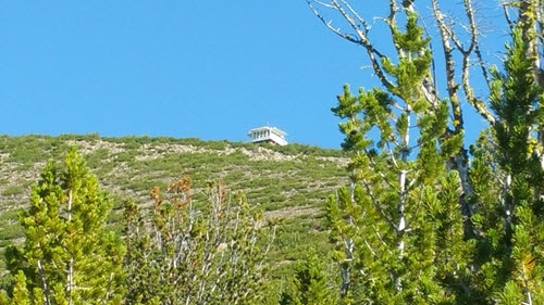 LOOKOUT AT THE SUMMIT OF ST. MARY PEAK, BITTERROOT VALLEY MONTANA
The trail is approximately 3.13 miles long and is very well maintained. The lookout at the top was used to spot forest fires but is now maned by volunteers who welcome visitors and this fun get-a-way. The trail climbs roughly 2500 feet over the distance so it is a bit of a work out.
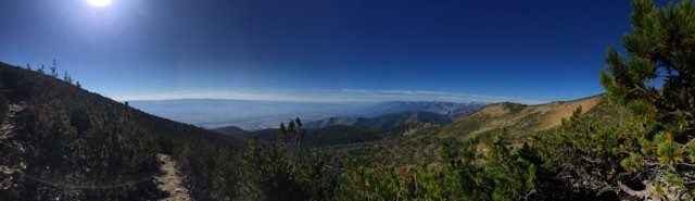 PANORAMIC VIEW OF THE BITTERROOT VALLEY FROM ST MARY PEAK
On a clear day you can see mountains of the Mission, Swan, Rattlesnake, and Garnet Mountain Ranges to the north and northeast, the Sapphires to the east as well as the Flint Creek and Anaconda Ranges to the east and southeast and the Beaverhead Range to the south.
Learn more about the trail and directions at Summitpost.org.
HEY, IT'S ST. MARY PEAK, JOKER.
Bitterroot Valley Real Estate- Craig Siphers, Senior Broker
Providing trusted consultation on buying and selling Montana
real estate for over 30 years in Lolo, Florence, Stevensville,
Victor, Corvallis, Hamilton, and Darby. Call or text Craig Siphers
at 406-360-9108 to make a legendary deal!